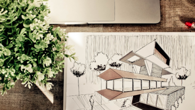

Point clouds are a set of points in a three-dimensional space that represent the shape of an object or surface. These points are obtained through acquisition technologies, such as laser scanning or photogrammetry, and are stored in a digital file. Point clouds are used in a wide range of fields, from engineering and architecture to film and video game production. Starting from the point cloud, it is possible to create high-precision 3D digital models for inspection, surface analysis, construction planning, and geographic data visualization, among other applications.
In general, the purpose of point clouds is to provide an accurate and detailed representation of the geometry of an object or surface in a three-dimensional space for use in a wide range of applications.
For example, in engineering, point clouds are used to inspect the quality of a surface or object and to detect any defects or deformities. In architecture, they can be used to create construction plans and high-precision 3D digital models to visualize the design and structure of a building. In film and video game production, point clouds are used to create 3D virtual characters and environments.
Table of Contents
PointClouds, from the 1960s to Today:
PointCloud technology has been in development since the 1960s, when it was used in military and intelligence applications to create 3D digital models from aerial and satellite images. However, point cloud technology has significantly evolved in recent decades with the introduction of new data acquisition and processing techniques.
In the 1980s, laser scanning technology was first used to capture 3D data and create high-resolution point clouds. Starting in the 1990s, digital photogrammetry became a popular technique for acquiring point clouds, using digital cameras and image processing software to create 3D digital models.
In the 2000s, point cloud technology became even more popular with the introduction of specialized software for processing and analyzing point cloud data. Today, as we mentioned earlier, point cloud technology is used in a wide range of fields, from engineering and architecture to film and video game production.
How are point clouds used in an architectural project?
Point clouds are used in architectural projects to create precise and detailed 3D digital models of a building or site. These digital models can be used for a variety of purposes, including:
- Design: Point clouds can be used to create 3D digital models that serve as a starting point for designing a building or site. Architects can use these digital models to visualize the design of a building and experiment with different design options.
- Inspection: They can be used to inspect the quality of an existing building or site. Architects can use point clouds to detect deformations and defects in a building and then use this information to plan and execute repairs or renovations.
- Construction planning: Point clouds are also used to plan the construction of a building. Architects can use point clouds to create 3D digital models of the existing structure and then use this information to plan the construction of new structures or the renovation of existing structures.
- Presentation: Point clouds can be used to create visual presentations of a building or site. Architects can use 3D digital models to create visual presentations that help clients understand and visualize the design and structure of a building or site.


What are the advantages for an architect who uses point clouds?
Point clouds can offer numerous advantages to an architect in their professional career. If used and integrated correctly in projects, precise and detailed 3D digital models of a building or site can be obtained, which can improve the quality of the design, efficiency in planning and construction, and accuracy in inspecting structures.
Additionally, the use of point clouds can save time and reduce costs in the design and construction process, as they allow for better planning and timely error detection. They can also help architects communicate better with clients and other industry professionals, as they offer a clearer and more detailed visualization of projects.
Another advantage is that the use of point clouds allows for greater accuracy in the process of inspecting existing structures, which can improve safety and reduce the risk of property and personal damage.
In summary, the use of point clouds can be a great advantage for an architect if used correctly. They can improve the quality of design, efficiency in planning and construction, and accuracy in inspecting structures, save time and costs, and improve communication with clients and other industry professionals.
If you are interested in starting to use point clouds, here are some steps you can follow:
Get point cloud processing software: There are several software programs for processing point clouds, among the most popular are Autodesk Recap, CloudCompare, and ARCHLine.XP. Research and select the program that best suits your needs.
Choose a data acquisition technique: Point cloud data capture can be done using laser scanning techniques, digital photogrammetry, or by using a drone to capture aerial images. Research and select the data acquisition technique that best suits your needs and budget.
Acquire and process data: Once a data acquisition technique has been selected, you will need to acquire the point cloud data using the chosen technique. Then, import the acquired data into the point cloud processing software and make any necessary corrections.
Create a 3D model: Once the point cloud data has been processed, you can create a digital 3D model using the point cloud processing software. You can use this digital 3D model for a variety of purposes, such as construction planning or visual presentation.
Learn and improve: Point clouds are a technology that is constantly evolving, so there is always something new to learn and improve on. Stay up to date on the latest trends and developments in point cloud technology and continue to improve your skills in using this technology.
Remember that using point clouds may require a learning curve, so it is advisable to practice with small projects before tackling larger and more complex projects.
If you want to become a Revit BIM expert in only 17 hours, access GoPillar Academy’s online course for only 60 USD for a limited time.
For further information, please email [email protected]